Another beautiful photo, this time by Yvette Staelens


Photos and text by Shane Faulkner
This week’s session was quite a unique experience indeed, as we explored a nocturnal Avebury…
On arriving at Avebury, it was already cold and dark. We assembled in the public village carpark, especially eager for this week’s offerings. I personally, have never been around the stones at night, so I was glad of the opportunity and was looking forward to the experience. Above me, framed by eerie silhouetted branches, grey and misty clouds pushed through the cold night sky occasionally giving up an ephemeral, mystical treasure, the glowing crescent moon. We got clad in our cold weather apparel, had a brief catch up and chat before setting off. People appeared energised by the exciting and somewhat unknown adventure that lay ahead. With torches, head lights and phones at the ready, we made our way out towards the stones.
We traversed the south west sector of the henge, crossed the main road and entered the south east sector. Mist was starting to creep in all around us and the cold air was trying to bite. All of a sudden, out of the darkness ahead of me, appeared two huge grey figures. These figures stood sentry to a pathway yet trodden. Between them lay an invisible gateway, a portal, suggesting both start and ending. Slowly, more grey figures appeared to my side, flanking me as I preceded through the night.

Each figure grabbed my attention, their sense of presence was extremely powerful. As I approached the ‘gateway’, the huge grey figures loomed above and either side of me. I couldn’t help but feel honoured yet humbly uninvited as I committed to this path. The two huge entrance stones (no.s 1 & 98 – pictures below) mark the Southern entrance of the henge and the start of the ‘avenue’. Stone 98 is known as the ‘Devil’s Chair’. As the pathway winds and snakes down the edge of the hill you are greeted either side by animate forms. We were now all following the avenue of stones.


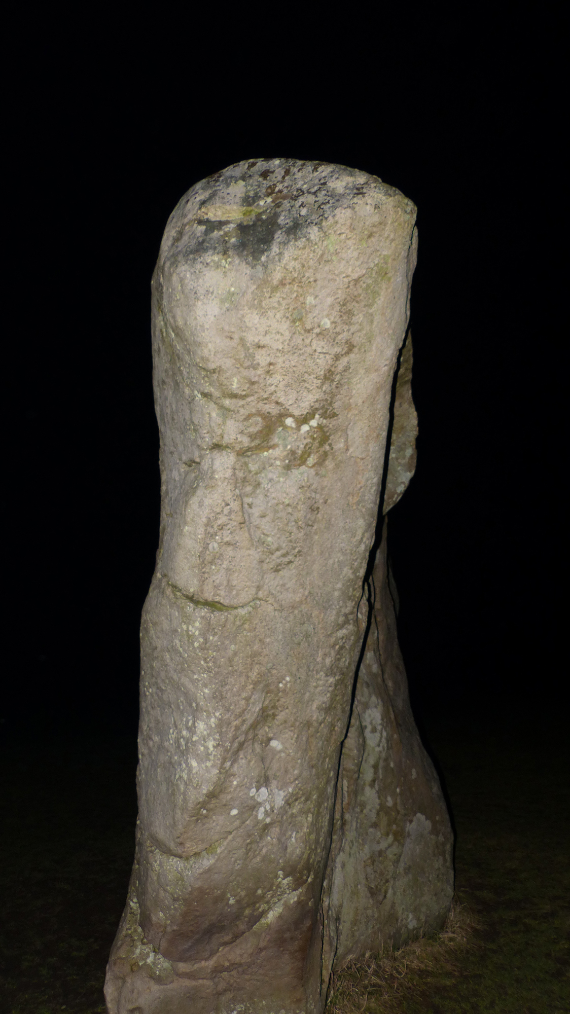
We stopped with Prof Tim Darvill at the top of West Kennet Avenue to talk about what the avenue might have represented for the early peoples. We tried to understand it through their eyes. We thought about its practical use and the possible symbolic meanings. What would the peoples have seen as they followed its winding path? Whether coming from the Sanctuary area or from the henge itself, there are many different and hidden perspectives as one travels its flowing length. Was the avenue used by many or just a select few? After contemplating these questions we preceded onwards.
More stones manifested out of the darkness, some of which were quite small; being the modern markers for where a stone would once have stood. One theory proposed by Keiller & Piggott is that the avenue & henge stones can be separated into male and female anatomical forms. These stones are labelled (Type a) and (Type b) respectively. The typical comparative example being stones 13a & 13b as seen below.

 To my side, Waden Hill rose gently off to the right, hiding the western horizon. I stopped to touch one of the standing stones. Were the stones trying to speak to me? I tried to communicate with these sentient figures but I am as yet not fluent in the language.

On reaching the end of the restored section of the avenue we talked about the connection between the Neolithic peoples and their monuments to the cosmos.
The Neolithic people had already built up a considerable astronomical knowledge base from earlier times. They were very familiar with the heavens, the sun, moon and stars. These Neolithic people had none of the distractions and visual entertainment of today. The day and night skies were their windows, their TV screens, their pages of a book and they would have spent much time observing them. They would have witnessed the movements of the celestial bodies, of the stars and the galactic plane. They also would have witnessed strange repeating occurrences such as eclipses. It was an ever moving story, of life and death, rebirth, symbolism, spirituality, the celestial sphere was their very guidance. The peoples would have planted and harvested by these cycles. They would have planned daily events and ceremonial activities in tune with the heavens. The celestial cycles help track the passage of time. Looking within Archaeoastronomy, the night sky inspired the building of the monuments. The monuments may have mirrored the night sky, “as above, so below”. The peoples of this time were looking for their identity within the great cosmos.
We gathered around an image of the impressive Bronze Age artefact, the Sky Disc of Nebra (see image below). The disc is understood to represent an astronomical clock, bringing together both solar and lunar calendars. The gold leafed highlights represent the sun, moon, stars (Pleiades) and an arc. The arc is interpreted by some as a sun boat (the sun would travel the waters of the underworld by boat every night re-emerging from the waters at dawn). We compared it to a modern planisphere that Danny was discussing.
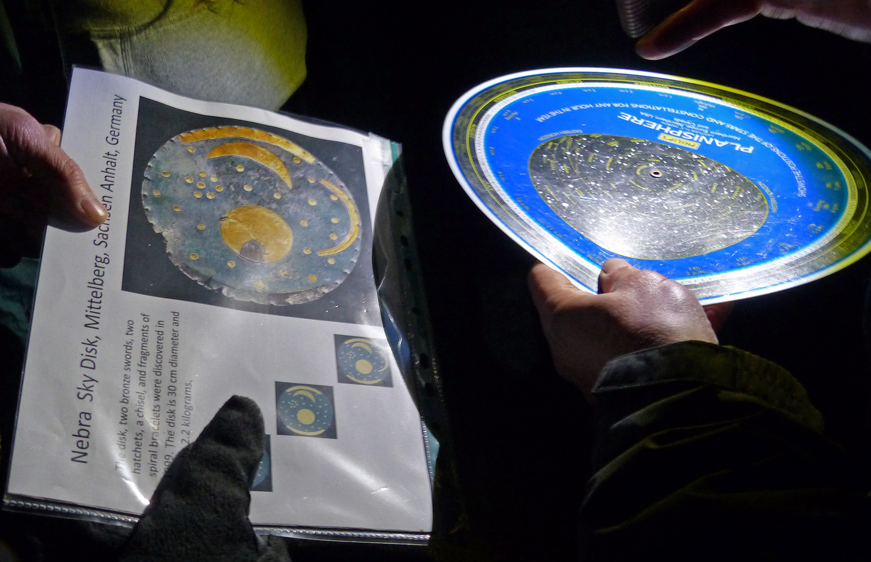 Luckily the cloud of earlier started to clear and the moon and stars revealed themselves. Another group member and I had brought telescopes, so we set these up so others could have a closer look at the night sky. We looked at the crescent moon and the shining Pleiades to peoples awe’s and wows. We also looked at the stars of Orion and the Orion nebula, the pole star Sirius, the constellations Gemini, Auriga, Taurus and also Ursa Major (aka the ‘plough’).

We ended the session walking back along the avenue toward the henge. Another person and I walked alone at the back. Being alone in the avenue, surrounded by grey figures and misty fields, shrouded by the starry night sky, the atmosphere felt heavy. I was being transported back in time to a place of unfamiliarity and yet, at the same time, feeling strangely familiar?
I looked up to the stars, the sky and the earth connected as one. I was being drawn in, into the briefest of glimpses of a cosmic plan. As I left the avenue behind, mist hung over the ground, the moon shone, stars twinkled, and all was still.
Next Week: Avebury Landscape.
Photos and text by Shane Faulkner
Awaiting us this morning as we all converged in the Ed room was another nice healthy buffet (courtesy of the lovely Yvette). This week’s featured fruit was the juicy Blood Orange. After everyone had arrived we settled down to some pre-outing talks.
Today we talked about aspects of archaeology. We discussed tangible cultural heritage, for example things that can be touched. We moved on to talking about intangible heritage i.e. songs, beliefs. Knowledge/knowhow, communications (language, instruments, visual, signs), myths, legends and folklore. Within the discussion, Yvette mentioned to a very interesting example of a language form. This was the whistling language called Silbo gomera, of La Gomera, Canary Islands. Well worth a look. We finished in the ed room hearing of archaeology as an ever evolving entity, all thanks to novel thinking and advances in transferable science and technology.
As in previous weeks, I again car shared with different members of the group. As we were setting off, I was asked if I would listen to music created, sung and played by one group member. I have to thank the person now, for what was a really emotionally moving journey. On arriving at Overton Hill/Ridgeway car park, I listened to a second song, this one taking me off into the distance with tears in my eyes. Thank you to this person for feeling you could share these personal lyrics with me! I will never forget that.
From the car park we headed for the road. We were somewhat behind the rest of the group at this point when, coincidently, and relating to the earlier talk about intangibles, there appeared to be some Gomeran sightseers, trying to communicate and sign with us? To the sound of whistles, I crossed the very precarious part of the A4, to reach the sanctuary of the Sanctuary.
We all gathered around a very knowledgeable Briony, who brimmed with passion for her subject and filled us with understanding of where we stood. I walked around the Sanctuary trying to imagine what it once may have looked like and tried to understand the reason/s for its use & position on this hillside. Very compelling.

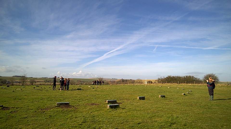
The sanctuary site once stood as a concentric ring of wood and stone, built in phases of wooden posts possibly then moving on to stone circles. The posts have long since disappeared and according to William Stukeley, the remaining stones were removed from the site between 1723-24AD. One theory, mentioned by volunteer Steve, suggests the removed stones were used to help build a farmhouse and wall within West Kennet. Today contemporary concrete blocks mark the sites of wooden poles and also of the stone holes. The site joined to the Avebury Henge by the processional way of the West Kennet Avenue. The entrance is to the west of the outer circle and consists of three larger stones. The exact purpose of the Sanctuary is uncertain, with many theories being passed around. I will leave the interpretation up to yourselves.
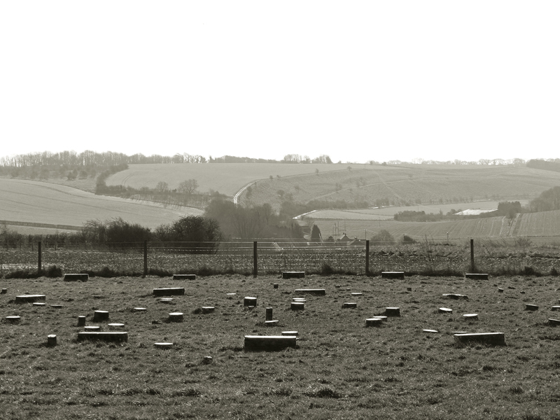

There are some great panoramas of the surrounding area to be had from this location. Looking down the eastern slope, I pictured an avenue of stones adjoining the remains of the existing avenue and tried to position myself, walking side by side, with the peoples of those times. I tried to imagine what it may have been like. I looked up and took a picture of this Yellowhammer, a bird that most likely was observed by these peoples as they walked this hill top long ago.

Crossing back over the A4 with our life in our own hands dodging roman chariots (me and my imagination!) we visited the Bronze Age barrow cemetery known as Seven Barrows. The name derives from the Anglo-Saxon ‘Seorfon Beorgas’ (In actuality, the site really consists of twelve round barrows). Ten of the twelve barrows are situated on the north side of the A4, the other two being to the south of the road. We had visited these last two barrows first. I became aware of the bowl barrow south of the Sanctuary. This barrow had been flattened much by agriculture but originally had a diameter of 40m and a height of 3m. The barrow contained no evidence of a ditch or remains. (see pic below). Adjacent to the Sanctuary lies a bowl barrow, this example was originally surrounded by a ditch feature. The barrow contained an inhumation burial, a dagger and axe, a pin and a tree trunk coffin – that is, I’ve read. We didn’t actually excavate it ourselves! …wasn’t time.

The prominent mounds to the north of the road consist of the five barrows, four are examples of bell barrows, with a smaller fifth bowl barrow in between. All of these barrows contained cremation remains. The general construction of these barrows consisted of building material up and around bodies/remains within. The barrows had secondary use by peoples of other periods spanning hundreds of years. Often, later surface burials or burials nearby were created.
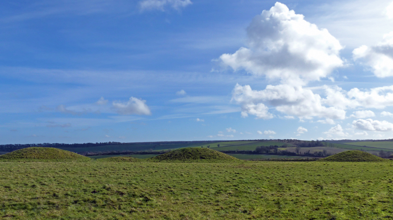
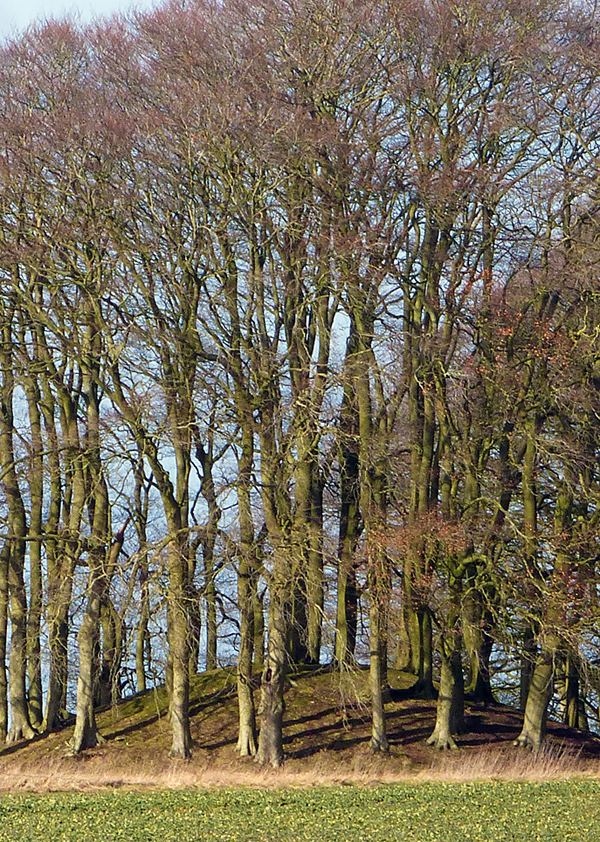
Briony also showed us the site of the old roman road and some special burial mounds. These included a Bronze Age bowl barrow, a Saxon/pagan inhumation cemetery and lastly, three unique Roman burial mounds. This portion of the site consists of a rare mix of burial mounds from a mix of differing time periods. The older Neolithic Bronze Age bowl barrow, is of a rarer form reminiscent of Beaker period styles seen in Wales. The three Roman burial mounds positioned next to the roman road, are said to be a very unique occurrence to Britain. Were these romans inspired to take on local customs? Briony then showed how these roman barrows were encircled with post holes creating a fence. They contained cremation pits and burial remains. The Anglo Saxon secondary editions to the site contained weapons and remains. In the opposite direction across a field, beech covered Bronze Age round barrows were seen. The one photographed below being an example of a well preserved bell barrow.

It was then everyone’s favourite sing along time. There were no skylarks present this week, I guess the larks knew they couldn’t compete with us! We all sang a live rendition of ‘living bell’ courtesy of Yvette, with some fun and games mixed in courtesy of Danny.
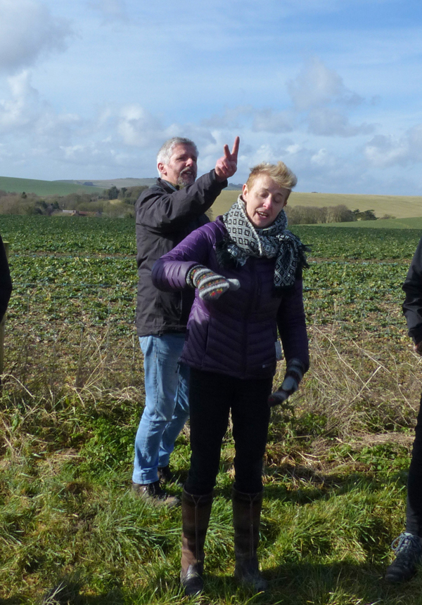
Afterword’s, I took some time out to breathe in my surroundings. I noted the barrows studding the landscape with a soft, non-angular, lush green undulating flow, highlighted by a bright blue winter skyscape, just lovely. I must come back and take photos under different settings.
We walked back along the Ridgeway to the car park chatting. There is a nice familiarity growing within the group as we get to know each other. I got stopped and had a chat with an interesting local man who was living in a large truck. He knew a lot about the local sites and mentioned his adventures with a metal detector, he had yet to find that elusive roman gold hoard! We all drove back to the ed room to have lunch and conclude this week’s session.

Next week: West Kennet Avenue – Night Walk!

Friday 13 April 2018
10:00 – 17:00
Fusion Building, Bournemouth University, Talbot Campus, BH12 5BB
Using historic landscapes and heritage resources of various kinds to promote well-being represents one of the most significant advances in archaeological resource management for many years. Its potential contribution to health-care and wellness initiatives is boundless. Prompted by the ongoing HLF-funded Human Henge project, this conference provides an opportunity to hear about this and work going on across the country and at many different scales, share experiences, and to discuss the outcomes, implications, and theoretical underpinnings of heritage-based well-being projects.
Please use the Eventbrite link to book a place at this free conference
09:30-10:00 COFFEE (Poster displays available for viewing throughout the day)
10:00-10:15 Dr Sara Lunt (Chair, Human Henge Board) and Professor Timothy Darvill (Professor of Archaeology and Director of the Centre for Archaeology and Anthropology, Bournemouth University)
Welcome and introduction
10:15-10:30 Liz Ellis (Policy Adviser Communities and Diversity, Heritage Lottery Fund) and Alice
Kershaw (Head of Business Process Review, Heritage Lottery Fund)
Mental wellbeing and historic landscapes: the heritage context
10:30-10:50 Dr Toby Sutcliffe (Avon and Wiltshire Mental Health Partnership NHS Trust)
Therapeutic landscapes past and present: the mental health context
10:50-11:10 Laura Drysdale (Director of the Restoration Trust)
Walking with intent in ancient landscapes
11:10-11:30 Professor Timothy Darvill and Yvette Staelens (Senior Teaching Fellow, Bournemouth University)
Monuments for life: Human Henge at Stonehenge and Avebury
11:30-11:50 Dr Vanessa Heaslip (Principal Academic in Adult Nursing, Bournemouth University)
Human Henge: Stonehenge as a healing environment in the 21st Century
11:50-12:10 Martin Allfrey (Senior Curator of Collections, West, English Heritage) and Briony Clifton
(Assistant Archaeologist, National Trust)
Past Perceptions: people changing places changing people
12:10-12.30 Discussion
Led by Daniel O’Donoghue (Wiltshire Locality Manager, Richmond Fellowship) and members of Human Henge.
12:30-13:30 LUNCH
13:30-14:00 Claire Nolan (Department of Archaeology, University of Reading)
Therapeutic landscapes of prehistory: exploring the therapeutic value and potential of prehistoric landscapes for the present day
14:00-14:30 Dr Ellie Williams (Lecturer in Archaeology, Canterbury Christchurch University) and Dr
Lesley Hardy (Senior Lecturer in Archaeology, Canterbury Christ Church University)
‘The People Before Us’: exploring heritage and wellbeing in coastal Kent
14:30-15:00 Mark Evans (CEO Waterloo Uncovered) and David Ulke (Welfare Officer, Waterloo Uncovered)
Battlefield archaeology and recovery
15:00-15:30 AFTERNOON TEA BREAK
15:30-16:00 Helen Johnston (Thames Discovery programme, Museum of London Archaeology)
Messing about on the river: Volunteering and well-being on the Thames foreshore
16:00-16:30 Rebecca L Hearne (University of Sheffield)
The archaeological imagination: alternative ways of seeing for mental health recovery
16:30-16:45 Discussion
16:45-17:00 Alex Coulter (Director of Arts and Health South West)
Summing up

Human Henge Avebury: Session 5 at Sanctuary and Ridgeway Barrows, Friday 16th February 2018
All photos by Yvette Staelens



With the alarm set for 7:40am, I went to sleep with the anticipation of tomorrow’s adventure. All
prepared the next morning, I awaited pick up by my personal chauffeur (he never wears a suit and tie?). We set off to pick up someone else in a nearby town. In passing along the roads to Avebury, taking in the scenery of deep rural Wiltshire, there is always time to contemplate life’s important things. Like, how will the day’s challenges go? What are my goals in life? Where do I want to be this time next year? When will spring arrive? Did I turn the grill off and lock the front door!? (We’ve come too far too turn back now!).
The weather man had forecast wintry showers for today and on arrival there was a keen chill to the wind. On passing the barn gallery, I could not miss the looming storm clouds brewing up from the north. Was that rain clouds or snow clouds I wondered, as I headed inside?
Today in the Ed. room, archaeologist Dr Sara Lunt, Assistant Archaeologist at Avebury Briony Clifton & voice practitioner Yvette Staelens got down to talking about many topics with a central theme around stone. We talked about the sarsen stones that are very numerous in this area and there significance to prehistoric man. We also talked about prehistoric axe heads, with an example passed around for us to examine. This axe head example had been reworked then discarded during the rework. It was a heavy, polished stone with an obvious cutting edge.
During the Neolithic period, agriculture and improved settlement created time and need for
specialisation of tools. These tools were used for cutting wood and clearing ground, for skinning, scraping, butchering and for protection. A high level of workmanship went into making the utility tools. Tools were discarded if impurities or weaknesses were discovered. Axe heads could be made from hard stone and flint which would be chipped, (called knapping) flaking pieces from the main body to create a sharp edge. These tools were often traded or passed within families, generation to generation.
This topic led onto the mention of the ‘Polissoirs’ or polishers. Polissoirs are hard stones that were used to shape and polish flint & stone tools, for example the flint axe heads. Within the Avebury area, sarsen stone was used due to its hard abrasive nature. There are some good examples of Polissoirs to be found locally. Some Polissoirs were later incorporated into the building of the monuments themselves. The stones are generally large and flat, with highly polished indentations being seen running across then. An example of a polissoir made by a student was shown and the smooth surface was very obvious to the touch.
The Preseli Bluestone was also mentioned and passed around. The bluestone comes from
Pembrokeshire, Wales and was used in the construction of some of the inner sections at
Stonehenge. Being igneous in form, the bluestone can be traced back to a precise origin. This
bluestone contains spotted dolerite, local to these Welsh hills. We talked about the movement of this stone and how that may have happened. It was nice to see people discussing the subject
matters with a real honest passion. A level of passion I could relate too with my core interests.
…Then all of a sudden and in answer to my earlier thought, outside it had started to snow!
Eventually turning into proper thick snowflakes too! With the inner child in me brimming, I wanted to go outside and run about in it. I believe at least one other person in the room was feeling the same thing too – (You know who you are). After some more informative talks we headed out to see some sarsen stones in situ. The snow had now stopped but the wind chill was still felt.
We arrived in the picturesque village of Lockeridge to explore the sarsen stones of this area. We
entered Lockeridge Dene by the gate at the front of the site, stopping to read the info board.


We passed many examples of sarsen stones, the whole valley was speckled with them. After a
short time, the sun started to emerge out of the snow clouds, creating a good opportunity for
photographing the stones. As we walked along we listened to talks given about this site from
National Trust Ranger, Peter Oliver.
The sarsen stones are a siliceous form of sandstone called silcrete. Owing to the high composition of silica the stone is very hard. The name ‘sarsen’ is usually said to have been derived from the word ‘Saracen’, meaning foreign/alien (i.e. the Arabic/Muslim peoples mentioned in the crusades). I also came across a different origin relating to the Anglo-Saxon word ‘sar stan’ or ‘sten’ which translates as ‘troublesome stone’. Another more contemporary name for sarsen stones is Grey wethers, (relating to the stones likeness from a distance to grazing sheep). The sarsen stone was created 30-40 million years ago, when this area was said to be a tropical wetland ecosystem. Sand and silica mixed under these water habitats and over time, cemented & solidified. Some sarsen stones still have the holes remaining where tree roots and trunks grew within the sands. This layer of sarsen stone was broken up around the last ice age and deposited predominantly within the valley areas by glaciation. These deposits being specifically known as sarsen drifts. This process, as well as heavy melt waters, finally created the landscape we see today.


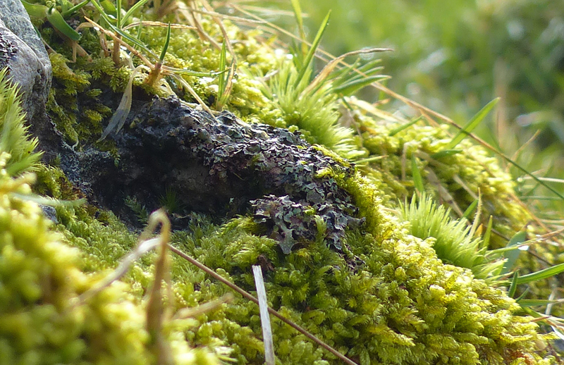
Personally, I have always found the stones owning a unique presence and awe within the landscape. Their feel, texture, patterns, the holes, the weathering, the lichen and the puddles, all owing to this uniqueness.


(At another nearby site, called Fyfield Down, the largest concentrations of sarsen stones in the
vicinity can be found. Having visited Fyfield Down on many occasions over the years, I never tire of walking in this somewhat other-worldly setting. So if there is anyone reading this that has yet to visit Fyfield Down National Nature Reserve, then I highly recommend it. A spring visit will see lots of bright yellow gorse out in flower. The smell of these flowers, is to me, reminiscent of coconuts).
Lockeridge Dene is also an important chalk grassland site with examples of many chalk grass related animal and plant species. The site lies on a south/south-east facing chalk hillside and can be a warm sight during the summer months. This warmth is loved by the Yellow Meadow Ant and much of the hillside is scattered with ant hill colonies. Whilst standing on the slope, we heard a brief talk about the chalk grassland ecology and talked about the flowers and butterflies seen here. We then talked about the lichen communities that are found on the sarsen stone. One particularly rare species being only found on this type of stone. I enjoyed photographing these sarsen stones decorated with colonies of lichen. Each stone has a unique pattern and composition of species.


 On the sunny walk back through the valley, I noticed and snapped this cheeky blue tit eyeing me from a bush.

We ended the session back at the Ed. room for a chat and some lunch. One member had brought back some tree lichen for us all to look at. They had also brought with them a nifty little hand lens so we could all see the lichen and stone examples up close and personal. Very cool!
I must say the project is something I look forward to every week. It is a nice place to meet interesting people, with the added bonus of lots of fresh air, scenery, history and nature. There are good conversations to be had and, of course, there is always something new to learn. Being involved with the project gives a sense of purpose, an act of doing and achieving. Granted, it may involve many great challenges, however, there is a huge potential of satisfaction waiting to be gained from it.
Next Week: The Sanctuary & Ridgeway Barrows.
Photos and text by Shane Faulkner
A lovely start to session 3 with clear blue skies, sunshine and good company.
We all met at the education room for our weekly catch up and chat. We gorged ourselves on
another tempting array of nibbles, which included chocky biscuits & Jaffa cakes. The nibbles were all washed down with hot beverages. After a while we were told two guests were waiting for us at the barrow, so we made our way out to the cars. It was decided that people who didn’t know one another were to go to the barrow together. Along the way the driver and I got chatting and before we knew it, we had ended up going completely the wrong way, being alerted to the fact by a fellow passenger! But not to fear, a quick 360 at the Red Lion pub and we were back on track down a sun filled West Kennet Avenue, happy days.
We again parked at the roadside car park at the base of Waden Hill. It was a bit of a tight squeeze getting us all in, but it all worked out in the end. A sunny stroll by the water meadow took us over the River Kennet and up to the metal gate. The gate being kindly held open by one member for everyone to pass. Our group then walked up the hill path to the barrow, the path having become very muddy by so many visitors.

The long barrow was now becoming dominant on the crest of the hill. On approaching the barrow we could hear ethereal tunes riding on the breeze. These tunes were of the flute being played by Maxence des Oiseaux, a French musician, who was standing by a large sarsen stone. The group gathered around to listen to the music and take in the views.

A short while later we were joined by Professor Timothy Darvill who gave a talk on the peoples of the barrow. The individuals discovered in the barrow all died within a short space of time, perhaps over six generations. However, the barrow remained open for ceremonial deposits for over a 1000 years. The long barrow may have been used as a way of marking a family owned territory. A place to celebrate the lineage of the families present. The large size of the barrow making it a prominent and noticeable land marker to other peoples for miles around.
There is evidence of transference of bones from here to local Windmill Hill at certain ceremonial
times of year. One time of year being that which we now celebrate as the pagan Samhain (1 st Nov) or the Roman All Hallows. Said to be the time when the worlds of the living and dead come together. The professor coined a term ‘the night of the living dead’ referring to the barrow as a burial place for the living. The ancestors of the peoples, through ceremony, were seen to be eternal, forever alive. This talk really set the scene for our entrance into the dark unknown chambers of the barrow itself.
The West Kennet Long Barrow was constructed around 3700-3635BC and is 104m long, making it one of the longest barrows in Britain. There are over 1000 barrows that have been discovered in Britain. West Kennet Long Barrow is of a type called the Cotswold-Severn and is similar to others within that area. The mound was formed by the digging out of ditches around the sides. Additional material was brought in from elsewhere. Only around 10% of the length of the barrow was used for burial. The rest of the mound contains a line of sarsen stones, a layer of chalk rubble and earth. The barrow contains 5 burial chambers. The chamber structures is supported by huge sarsen stones in a corbelling fashion and filled in with dry stone walling (oolitic limestone). The limestone was sourced from nearby calne but also near Frome. The chambers were thought to contain at least 46 individuals ranging from 3 – 50 yrs old. West Kennet Long Barrow was restored in 1956 to its present state by archaeologist Stuart Piggott.


We entered the 9m long central passage of the barrow waiting for our eyes to adjust to the dark
before making our way to the end. A few people were fearing the dark and closed space within. We passed the side chambers and entered the larger western chamber. Here we stood in a circle with Maxence and Professor Darvill in the middle. A few candles had been placed around the chamber giving it an eerie feel. The professor gave a small talk about the barrow and Maxence began playing a tune. Personally, I have been in the barrow many times before but I have never experienced an atmosphere quite like it when the different music was being played. It really did transport you elsewhere and made you contemplate a far off time, surrounded by distant ancestors. It was a special, somewhat meditative moment. The long barrow was being brought back to life!
Maxence first played a ceramic harmonic instrument that had no tuning holes. It played only one tune so the sounds created were made by the player’s mouth. We then listened to a hollowed out bone whistle, similar to one found at a long barrow. This whistle had 5 holes, whereas modern examples typically have six holes. A large horn of antelope was next up, which played a deeper, hollower sound.
We then moved to the forecourt of the barrow to hear some more instruments being played. Shown next was a llama bone flute, a traditional instrument from Peru. The flute has 4 holes and is embossed with precious stones and topped with a carved jaguar head motif. Other instruments included a swan bone flute & longer antelope horn.


 Emerging out of the barrow and back into the world of the living, we were greeted by sunlight and the song of skylarks. We all got into a line for a group photo along the stone façade and then preceded to sing the Human Henge classic, “piggy pig, dog dog”. We followed some steps up to the top of the barrow mound and walked its length. From here great views were had. We came around the flank of the barrow chatting as we walked. One group member noted how the meeting of people on this project really brings her out of herself. It is a way of escaping other things going on.


We all walked back the way we came to the parked cars, chatting as we went.
The day’s session ended back at the education room where we were treated to more of Maxence’s unique music. Thanks to a member of the group being fluent in French we were able to fully understand Maxence’s crafted instruments and passion for music. With music of a
medieval/renaissance style we were played out with a flute made from an elder tree and a large
antelope horn to finish.

What a lovely day!
Next Week: Lockeridge Dene.
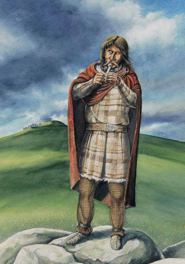
Iron Age Malham Piper by Peter Dunn, 2008
‘One of the secondary burials in the Seaty Hill Bronze Age Barrow on Malham Moor contained Iron and the pipe. This may be one of Max’s musical ancestors and he invoked the sounds of that time and many other periods. I imagined the piper living on in the beautiful Dales landscape through his music as his body was interred in the barrow.’
Peter Dunn
This is a presentation made by Dr Vanessa Heaslip, Deputy Head of Research Department of Nursing & Clinical Science at Bournemouth University, at TAG 2017 about her research into Human Henge’s health and social outcomes for participants.
Photos and text by Shane Faulkner
Today at the education room we were given an interesting talk about geophysical surveys and pottery.
A number of geophysical surveys of the area have been carried out with many potentially interesting results. Archaeological geophysics (sometimes called geofizz for short) is a non-invasive, non-destructive method of collecting ground based data associated with subsurface features. The final result being a mapped image of the area for interpretation. We were given copies of an image map of survey results for the general Silbury Hill/West Kennet area.
The whole area is covered in intriguing subsurface features relating to differing time periods. Most notable of these are features discovered just south of Silbury Hill. Here, survey results showed the presence of rectangle enclosures and buildings as well as roads, indicative of Romano-British settlement. Roman artefacts had already been found in the immediate area and were the initial pieces of the puzzle. The site is suggestive of a small Romano-British town, which would have overlooked Silbury Hill.
There is also a natural link for the location of the site and the presence of nearby springs. The association of springs and religious worship is well known (for example the Roman Baths) and the presence of the water systems provided such space for ritual practises as well as being crucial for agriculture. This in turn meant this was a rich area for growth & prosperity.
We then had a talk about pottery. A lot of the pottery vessels found at Windmill Hill were Neolithic round based bowls with some having lugs for suspending. It has been discovered that a small proportion of pottery found at Windmill Hill originated all the way from the gabbro outcrop on the Lizard Peninsula, Cornwall. The specific composition of this clay means we can locate it to a small area of the Lizard around St. Kerverne. This clay, named gabbroic clay, was gathered to make most of the pottery within Cornwall. The clay shows specific inclusion of gabbroic rock such as feldspars, pyroxene minerals called augites and mica. This gives the gabbroic pottery a flecked appearance. This got us all considering how things were moved around during the Neolithic period. Did the clay travel out from Cornwall, or were the pots made in Cornwall first then travelled out on trading routes?
We finished the meeting by writing a personal message on a ribbon to hang from the willow tree at Swallowhead Springs; our next destination.
Our small convey headed down West Kennet Avenue to the roadside car park to walk to the springs. Furnished with cold weather clothing, boots, wellies & ribbons, we set off down the track towards the River Kennet. We crossed the bridge over the chalk stream and took in the surroundings. From here are great views of Silbury Hill and you can also see the top of West Kennet Long Barrow just noticeable on the hill ahead. The long barrow will be next week’s destination.
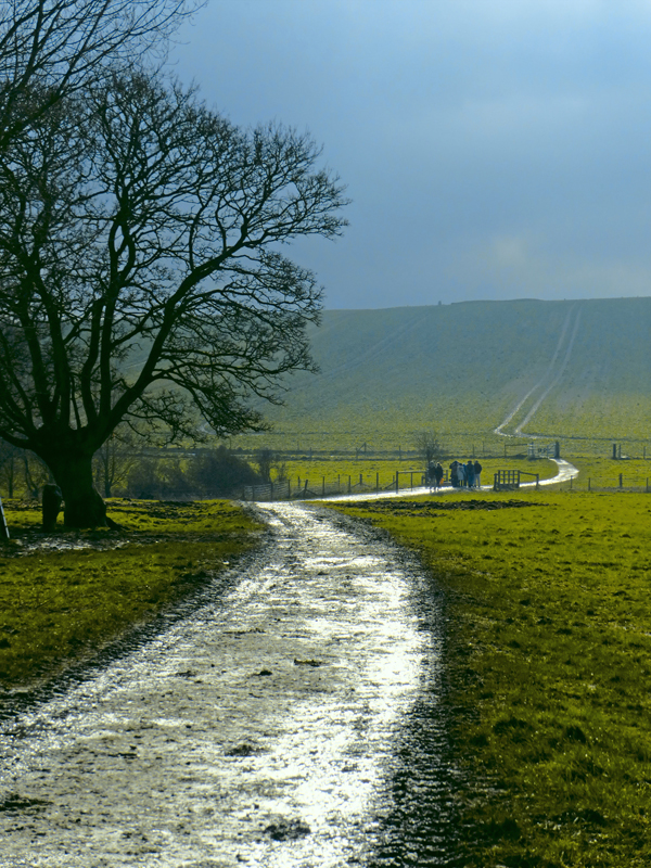

We detoured away from the barrow path, walking alongside the Kennet and past a small copse. On the track was noticed a deer print. Too small to be from a Roe deer it had to be a print of a Muntjack deer. On reaching the field corner we descended down a very muddy and slippery slope. After nearly losing a few fellow companions succumbing to the slopes’ wrath and passing an ill-omened dead bird, we all came out through a multi coloured willow arch, renewed and reborn on secluded sacred ground.


This sacred ground being the location of Swallowhead springs themselves. The site of two natural chalk springs, which at certain times of the year feed the River Kennet. A site revered for its sacredness, many people visit the springs to worship and partake in ceremonial practice with ritual offerings.

Here, worship of the Celtic goddess Bridget takes place. Bridget is associated with the return of the flow of life-giving waters and the return of spring. The sacredness of the site dates back far into the past, but how far is not certain. More recent lore highlights the importance of the spring’s sacred waters for religious ceremony. It is also interesting to note how over time the site has changed considerably, looking different to how it does for us today.
An excerpt from William Stukeley’s Abury (1743) reads,
“The country people have an anniversary meeting on the top of Silbury-hill on every palm-Sunday, when they make merry with cakes, figs, sugar, and water fetch’d from the Swallow-head, or spring of the Kennet. This spring was much more remarkable than at present, gushing out of the earth, in a continued stream. They say it was spoil’d by digging for a fox who earth’d above, in some cranny thereabouts; this disturb’d the sacred nymphs, in a poetical way of speaking.”
Another interesting fact about the site is that the water from the chalk springs can remain a steady 10C all year. Due to this the grasses and other vegetation around the springs often stay lush and green all winter. At the head of the spring lie some stones and on these all types of offering get placed. There were hope stones, crystals, coins, flowers and small wreaths as well as other symbolic offerings.
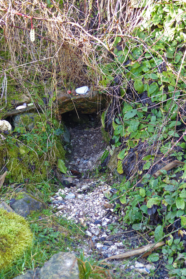

Hanging over the flowing waters from this spring grows a large willow tree. From this tree many personal items hang. We all tied our ribbons, also known as a cloutie, to the great willow as an offering, wish or prayer. We then listened as a prayer was made to the Great Goddess.


We partook in our own spiritual ceremony in an exercise of standing silent for one minute taking in our surroundings. We also had to guess when exactly we thought the minute was up and to contemplate on time itself. With the birds singing and the trickling of the Kennet in the background, a beautiful song was then sung. The song really made the sacred site come to life, evoking all sorts of emotions and linking the present with the past. We separated, with women on one side and the men on the other, all held hands and sang our own songs in coordinated fashion. A very uplifting moment.
Across the River Kennet have been placed large crossing stones and this was to be our way back. It was time to sharpen our senses as the crossing was a precarious one with some wobbly moments. With the imaginary soundtrack to Indiana Jones playing in the background, we all made it across the river safely. Admittedly, the water was only knee deep at most but I’m sure I spotted some crocodiles!
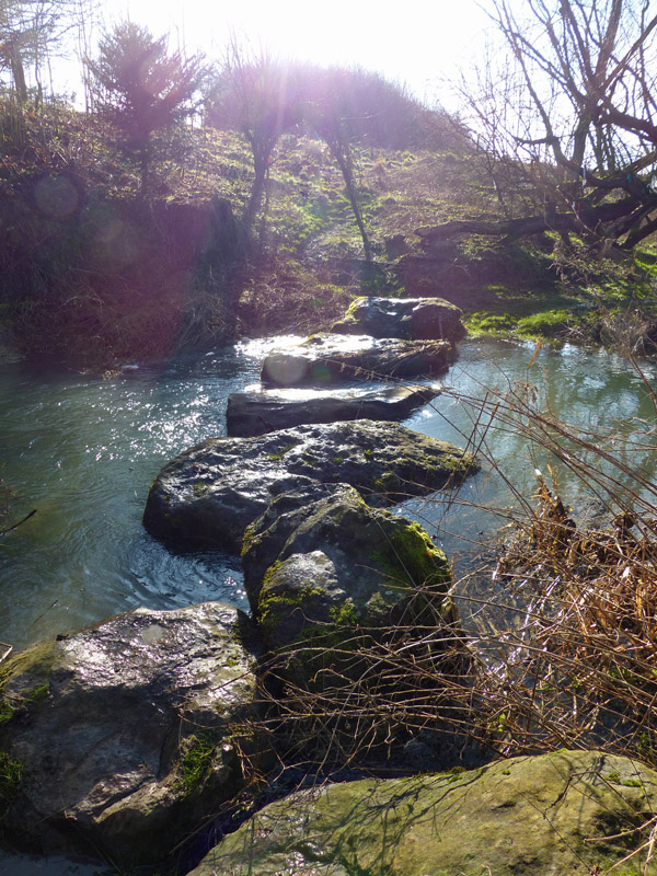
We all walked back to the car park across water meadows and headed back to Avebury education room feeling tired yet revitalised by the cold fresh air.
Another lovely, in depth, educational session.
Next Week: West Kennet Long Barrow!